


anse couleuvre-cascade couleuvre

XavierFaidix
User

Length
4.4 km

Max alt
341 m

Uphill gradient
331 m
Km-Effort
8.8 km

Min alt
20 m

Downhill gradient
328 m
Boucle
Yes
Creation date :
2019-04-01 20:34:48.239
Updated on :
2019-04-01 20:34:48.293
1h13
Difficulty : Medium

FREE GPS app for hiking
 SityTrail
IGN / Geographical institutes
SityTrail Plus
The world is yours!
About
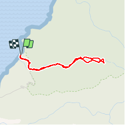
Trail Walking of 4.4 km to be discovered at Martinique, Unknown, Le Prêcheur. This trail is proposed by XavierFaidix.
Positioning
Country:
France
Region :
Martinique
Department/Province :
Unknown
Municipality :
Le Prêcheur
Location:
Unknown
Start:(Dec)
Start:(UTM)
691654 ; 1641659 (20P) N.
Comments
très belle cascade à l arrivée